


 For all latest news, follow the Daily Sun's Google News channel.


Two unprecedented events set to collide in new climate extreme
CNN
Published: 13 Nov 2026, 06:56 AM
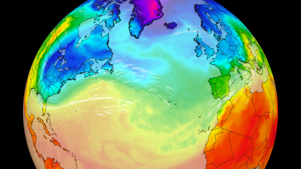
Illustration: CNN
High in the atmosphere above the Arctic, something strange
is happening: the polar vortex has broken down earlier than ever recorded, a
phenomenon that can trigger a blast of cold weather in parts of the Northern
Hemisphere.
However, there’s also another unprecedented force at work in
the form of a historically strong El Niño, which typically drives warmer global
temperatures. It’s setting up an atmospheric battle for influence over our
weather — and it’s not yet clear which will win.
The polar vortex is a belt of strong winds high in the
atmosphere that tightly hugs the Arctic’s frigid air, keeping it locked up
around the North Pole. It forms every fall as the sun sets on the top of the
world and the dark Arctic nights begin.
Although it exists in the stratosphere, about 10 to 30 miles
above the Earth’s surface, it can play a strong role in shaping the Northern
Hemisphere’s winter weather patterns.
For the past few weeks, the polar vortex has been weakening.
Right now, the air in the stratosphere is warming dramatically in a phenomenon
known as a “major sudden stratospheric warming” event, where the polar vortex’s
winds reverse. In the days and weeks after this happens, Arctic air can spill
south into the Northern Hemisphere, loading the dice in favor of cold air
outbreaks.
“This year is exceptionally unique,” said Andrea Lopez Lang,
a meteorologist at the University of Wisconsin-Madison. Major stratospheric
warming events typically occur between January and March, with the previous
earliest event happening on November 28 in both 1968 and 2025.
It’s not yet clear why this disruption is happening so
early. It’s possible El Niño may have played a role — some research has linked
it to a weaker polar vortex and more frequent major disruptions. “But we’re not
sure yet,” said Simon Lee, an atmospheric scientist at the University of St
Andrews.
What’s certain is that its unprecedented nature makes it
hard to understand exactly how the impacts will play out and where. “It’s
happening so early in the season that basically our historic events don’t
capture what’s actually happening,” Lopez Lang said.
The first taste of winter
Parts of the US and Europe will get their first taste of
winter this week, with a blitz of cold conditions that may have ties to the
polar vortex disruption.
A blast of Arctic air spilled out over North America and Europe Wednesday, which will last into the weekend — with peak cold on Thursday or Friday for most places. This will mean widespread frost, the first for much of the Eastern US and Northwest Europe.