



 For all latest news, follow the Daily Sun's Google News channel.


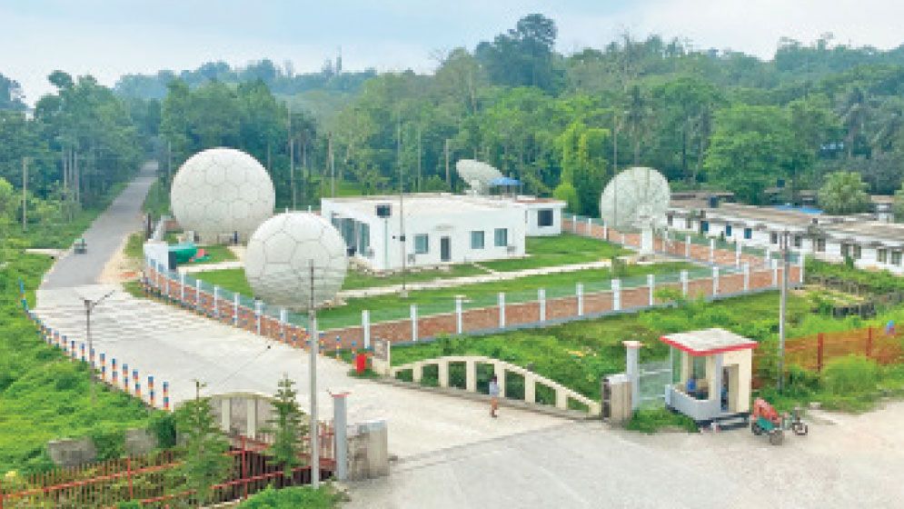
Bangladesh is set to enter a new era of marine research and ocean monitoring today with the inauguration of the country's first Ocean Satellite Ground Station at Chittagong University (CU).
The facility, named the Satellite Ocean Observation and Data Innovation Centre, has been established under a joint initiative of CU and China's Ministry of Natural Resources. It is expected to strengthen disaster forecasting, climate research and blue economy exploration.
Once operational, the station will connect directly with 11 Chinese ocean-observation satellites, enabling Bangladesh to receive near real-time data on the Bay of Bengal, coastal climate systems and marine resources. Officials and researchers described the project as a historic milestone that will reduce Bangladesh's dependence on foreign sources for oceanographic data and help create a national repository of marine information.
State Minister for Land and Chattogram Hill Tracts Affairs Barrister Mir Mohammad Helal Uddin is expected to inaugurate the facility.
The ground station has already completed successful trial operations and established communication with all 11 satellites, according to project officials.
The facility will receive continuous data on sea surface temperature, cyclone formation, storm surge risks, coastal erosion, ocean currents, fisheries distribution, chlorophyll concentration, salinity and other critical marine indicators.
Dr Mohammad Muslem Uddin Munna, director of the project, said the station would open a new horizon for marine science in Bangladesh. “For years, the absence of continuous ocean data has been a major obstacle to advanced marine research in Bangladesh. With this station, we will have uninterrupted access to real-time ocean information, enabling students and researchers to conduct world-class research and build a stronger scientific understanding of the Bay of Bengal,” he said.
One of the project's major benefits is expected to be improved disaster preparedness. Bangladesh currently relies largely on foreign agencies and international satellite systems for ocean and cyclone-related information, a process that can take up to 20 hours.
Officials said the new station would reduce that timeframe significantly, making cyclone, storm surge and other hazard-related information available within 15 to 20 minutes of satellite acquisition.
The facility is also expected to improve forecasting of cyclones, tidal surges, coastal flooding and climate-related risks across Bangladesh's vulnerable coastal regions.
The project, officially titled Satellite Ground Station for Marine Remote Sensing (SGSMRS), has been implemented with support from China's Second Institute of Oceanography at an estimated cost of Tk70 crore.
University officials said the Chinese institute financed and supplied most of the sophisticated equipment, while CU provided infrastructure and research support. Bangladesh secured the project after competing with several other interested countries.
Experts believe the station will play a key role in exploring the full potential of Bangladesh's maritime territory. It will support fisheries management, marine biodiversity research, offshore resource exploration, climate monitoring and coastal planning through the generation of accurate, real-time oceanographic data.
University authorities also expect the centre to evolve into a regional marine data hub serving researchers, government agencies and commercial users in the future.